Our last travel log had us heading to Nevada (or California, depending on which side of state line you’re visiting when in South Lake Tahoe). I’m glad we were able to cross this one off the bucket list because Lake Tahoe was far more beautiful than I could ever imagine. Fair warning, though! As relatively new trailer owners, we were pretty nervous driving those roads to the top. Some switchbacks were dangerously tight for us and our almost 30-foot rig, but we made it and paid for a camp spot among the trees in South Lake Tahoe.
South Lake Tahoe
We happened to host our Lake Tahoe workshop on the Sunday right before Memorial Day, and it gave us a chance to see a side of Lake Tahoe most people don’t. My cousin lives in Reno and ventures there often, but she warned us that Memorial Day weekend at Lake Tahoe was comparable to July 4th or any other epic celebratory bash we’re used to. The crowds would be wild and it might impact our workshop and live shoot. Well… it snowed. Beyond anyone’s belief, it was snowing, in June, in a place where all the locals and many tourists come to party and celebrate the holiday weekend. It kept the crowds at bay and we had a pretty quiet campsite. One morning we even woke up to soft, new snow falling through the trees and making our Airstream dreamy… and frigid. But so dreamy.

Our first day there was set aside for a hike to Emerald Bay. The views from the parking lot were truly breathtaking, with snow-capped mountains hugging the blue water below. The steep hike down was easy but I’ve lived at or below sea level my whole life so the way back up was challenging for me. Especially at almost 7,000 feet. But once we were down at the bottom, I was officially aware of the humbling views of Lake Tahoe. This little bay was just an introduction to the much larger lake that awaited our workshop live shoot, where we ventured to Lakeview Commons and had the beach mostly to ourselves. The sun even managed to break through the clouds for a beautiful sunset.
Hickison Petroglyph Recreation Area
Our Airstream is equipped with heat, but this Florida girl can’t handle her snow. We packed up after our Lake Tahoe workshop and headed toward Utah, trying to give ourselves enough time to experience the National Parks fully on our route. We’re constantly seeking out free campsites, BLM land and National Forest territory that permits boondocking. We admittedly stayed at a Walmart the night before, plotting out our route (thank you, Walmart!), and we found a spot that immediately intrigued the archeologist inside Corey. We arrived at the Hickison Petroglyph Rec Area and were surprised to be the only RV there.

We had all the site to pick from and we found a great pull-through location, near the exit. This would allow us an easier time when leaving before the sunrise, but we also scored a really cute spot with a covered picnic area, campfire, and BBQ. We got the cats all set up inside with food, water, and open windows that invited a cool breeze. We harnessed up the dog and went on a hike that truly surprised us! The half-mile Petroglyph Trail was easy to navigate and gave us an inside look at the life that inhabited the area almost 10,000 years ago. The giant boulders lining our route were covered in ancient petroglyphs and stories from a time long before our own. They showed signs of wildlife, rainfall, and community. We hiked to the top of the hill and had a stunning 360-degree view of the changing Utah landscape. But we could also see threatening storm clouds heading our way so we made the hike back down and started a fire before the rain hit.
Bonneville Salt Flats
I cannot properly explain my excitement for the Bonneville Salt Flats International Speedway. It has been high on my list for as long as I can remember, and I knew we couldn’t pass through Utah without making the pit stop to see it. I really appreciate the fact that this area is open to vehicular explorations. It was a cool 105 degrees when we went to visit and we’re so glad we had our truck close by to give us some sort of air-conditioned relief. You can stop at the rest area and walk right onto the salt flats, but I have to warn you that the westbound highway is the only one with pedestrian access to the incredible salty landscape. We made the mistake of booking a campground on the west side of the salt flats and driving back east to access it. The eastbound rest area does not have access to the iconic area, and we had to drive a half-hour past it, to find an exit that allowed us to turn around. So keep that in mind! If you want to drive out onto the salt flats... go for it! When you’re on I-80, look for Exit 4 and Leppy Pass Road. This road takes a sharp right and immediately becomes Bonneville Speedway Road, and your access to the salt flats in your own car.

(Travel Tip: Bring sunscreen, lots of water, and stay hydrated! I was honestly surprised at how manageable the 100+ degree heat was. We were able to be outside and shoot for a couple of hours without any real issue. If you drive on the salt, make sure you stop by a car wash or detail your vehicle yourself. We found hidden salt clumps under our truck for days! And don’t forget to only use designated access points onto the salt flats. We saw multiple places where vehicles went off the road and either got stuck or caused unnecessary damage to other parts of the area. Don’t be that person.)
Utah Rest Stops
Once we passed the Utah border, we began seeing ample amounts of pull-offs and rest areas, each encouraging travelers to stop a moment and take in the grand landscape before us. We finally decided to give in to temptations and made a pit stop at Sand Bench View Area, and I’m so thrilled we did. The blue sky contrasted the warm tones of the desert, and there was a Native American family selling handmade jewelry, pottery, and more. It was a gentle reminder of where we were, and the history ingrained in it. We took some time climbing the rocks, getting vantage points of the valley below us. The small amounts of water we could see were tainted with concentrations amounts of salt, and had a history preceding us. The valley was a stopping point for Brigham Young and his community on their journey to find what would become Salt Lake City. The Native Americans warned him that the “bad water” killed off many of their women and children, so Young continued on. We embraced the Utah sun and kept driving toward one of the coolest free campsites ever.

Northern Moab Free Campground
Not all campsites deserve their own section, but this one certainly does. We arrived later in the day than we wanted to, but those rest stops were too cool to pass up! As we turned into Northern Moab Free Campground, it was very apparent we weren’t the only ones to know about its existence… and rightfully so! We were only a few miles from the National Parks, and this site was easily accessible and quite spacious. From the moment we entered the campground, we saw dozens of rigs, tents, adventure vans—you name it! But they were obviously very courteous to one another and allowed enough space between each setup. We located our spot and set up the Airstream, ensuring it was level and in a good spot for solar (not hard in Utah!). We stayed in this spot for a couple of days, but Corey could have lived here easily. You see, directly behind our Airstream we found something pretty momentous. Dinosaur tracks. Honest to goodness, real, authentic fossilized dinosaur tracks. At first, we were skeptical, but after some research, we found out the campground was home to literally hundreds of dinosaur tracks. Most were marked, but the ones we found behind our campsite were not marked on any trail or map we found. We compared them to other tracks that had been documented and posted online, and these were, without a doubt, the prints of a theropod. The valley that became our free campground was once home to an abundant lake that nurtured the surrounding wildlife… aka, dinosaurs. Petroglyphs and dinosaur tracks, all in one trip? Corey is living his best life.
Canyonlands National Park
I want to mention that our travel logs are not the end all, be all, of National Parks. We won’t be able to hit them all (American Samoa is pretty out of the way), and we won’t even be able to explore the parks to the fullest extent. These articles are a travel log of our experiences, and what we were able to accomplish on our tight schedule. I implore you all to go out, visit the National Park system and start writing your own travel log!

We dedicated a day to Canyonlands National Park, and planned it so we could experience sunset. I’m not sure why gray skies seem to follow us wherever we go, but we made the most of it. Our first stop was Grand View Point Overlook, the farthest overlook and stop in the park (besides the incredible amount of back-country hiking available in this park). We got a parking spot, and took note of the multiple people who parked their small car in an RV only spot. We didn’t have Clementine with us or else we would have been super bummed, but we found a spot and walked out to the view point. Most people turned and ventured back to their cars after taking in the view and reading the plaque, but we heard about Grand View Point Trail, which runs along the valley ridge with steep drops below and incredible views. The trail was marked by established cairns (stacks of balancing rocks) and though it was hard to see them at times, we’re glad we were never led astray by tourist-made cairns. From this vantage point, you can see where the Colorado River and the Green River collide, after millions of years of creating the landscape before us.
(Travel Tip: Leave it better than you found it! That means not carving your names, walking off trail, or making your own cairns.)
From there, we headed to Mesa Arch, a sight I’ve been wanting to experience for years. We were driving on a road called “Island in the Sky” and the map proved the reasoning behind that name. It was as if the hard-packed rock and sand below us was floating over the canyon, with steep drop-offs on both sides of the road. The hike to Mesa Arch was easy and, though the park seemed crowded, the gray skies kept many people off trails. When we finally got to the iconic arch, we were alone and were able to experience it fully. We took our time photographing it from afar and then pushed ourselves to get closer and see the 800-foot drop below, perfectly framed through this ancient archway.

(Photo Tip: You definitely need a wide angle for this arch, or the patience to photograph it bit by bit, and stitch them together in post. The optimal time to photograph the arch would be at sunrise, so the sun can be seen through the archway.)
Our last stop was Island in the Sky Visitor Center. We wanted to see a different perspective of the valley below and watch the fading sun turn the gray skies a darker shade. We hiked down toward the cliff edge and, again, we were the only ones there. We grabbed our photos and then put our cameras away so we could experience the deep valleys, stunning canyons, and proud rock faces that created Canyonlands National Park. We gave out one good “woo-hoo” that echoed through the canyons and reminded us how small we truly are, and then headed back to our dinosaur campsite.
(Travel Tip: Looking for a real adventure? Only 4 x 4 vehicles with high clearance can take the truly epic 100-mile road around the canyon, called White Rim Road. There’s also a southern entrance that is far less visited but still has some breathtaking views, deep canyons, and Newspaper Rock! I visited this spot a couple of years ago and highly recommend it, but it takes about two hours to get there from the northern side of the park. Dead Horse Point is also located just outside of the Canyonlands northern entrance, but we were unable to stop for sunset because we weren’t prepared for the $20 fee to enter this site.)
Arches National Park
We woke up at 4:00 a.m., donned headlamps, and drove into Arches National Park. Our goal was to find the parking lot for Delicate Arch and make the hike in the dark, so we could be there for sunrise. Our luck had officially run out and we were not the only ones who had this idea. The parking lot was already filling up, at 5:00 a.m., and we could see hikers on the slick rock in front of us. Again, this Florida girl can hang, but steep inclines are my enemy. We paced ourselves and started on the 3-mile round-trip hike to Delicate Arch.

The first part of the hike is established along packed sand, paved trails, and one small bridge. You can see the Wolfe Ranch as you pass by, and I encourage you to stop a second, look around you, and imagine what it was like to settle that land, before anyone else really knew it existed. Incredible! From there, we took some switchbacks that help you gain the elevation you need to find the slick rock that will take you the rest of the way. Some trail markers can be seen in the form of old signs and faint footprints.
We huffed and puffed as we gained 500 feet in elevation, and then hiked along a thin trail that leads you directly to the arch. Once we turned the corner and saw the arch for the first time, the little breath we had left was taken away. A small crowd had already formed and, for the most part, it was a respectful and courteous bunch—except for the girl trying to feed the chipmunks her peanuts. I asked her not to feed the wildlife and I encourage you to do the same. Remember to practice kindness, but always demand other travelers obey park rules, respect the wildlife, and leave no trace behind them. We had even heard of people suspending ropes to swing from the arches, despite their fragility. Be the example!

Photographers had their tripods set up and everyone else had out their camera phones, grabbing photos of this iconic arch (it’s even on the Utah license plate!). I’m proud of the group that was up there with us because, for the most part, they all waited until the sun was fully up before forming a line for portraits under the arch. We were all able to experience the slow-moving sun as it lit up the arch and then one by one, took our turns venturing down, off the naturally made bleachers, to see the arch up close.
You can spend hours at this park, hiking to different vantage points and experiencing the more than 1,500 arches the park has to offer. Unfortunately, we had to hurry off and make it to our free campsite in Colorado, before it became too full and we lost our spot.
(Travel Tip: This arch also needs a wide-angle lens. I only had my Canon 40mm pancake lens with me and we were still able to frame the arch, but I know I could have snapped some better portraits with the wide angle, so the entire arch could be shown while still adding a more obvious human element. And don’t forget your water!)
Colorado
Our first stop in Colorado was Silverthorne for one of our workshops. We found our free campground by stopping at the Dillon Ranger Station, in the White River National Forest, and asked their opinion and recommendations for our 29-foot trailer. Though we had no service and often traveled into town to use free Wi-Fi or our hotspot, we were happy to be in our spot at the Columbine Landing Recreation Site. It was directly on the water and all we heard was the soft trickling of the river as we fell asleep. There were toilets available and, in the mornings, rafting crews would gather to drop off their cars, get suited up, and head upstream to begin their adventure. It was fun watching them come in and haul their rafts back to the trucks. They were always so excited and high from the adrenaline rush. I’ve rafted once, in Alaska, and I think it would be so fun to do it again in Colorado!

We hosted one of our workshop live shoots at Red Rocks, the iconic park and amphitheater. We made sure to keep south and follow the photo guidelines presented by the park. The red rocks glowed as the sun set, and the green grass created the perfect contrast for our shoot. We walked through the southern trails before calling it a wrap, when the sun set behind the ridge. The couple we were photographing decided to buy tickets for the live concert that night and ran off for a date night.
(Photo Tip: Remember, it’s far easier to call ahead, pay for a permit and shoot legally, than it is to pay a hefty fine and swallow that embarrassment.)
(Travel Tip: Want to hike around Red Rocks on the night of a concert? Enter from the south and tell the ticket attendant your intentions to hike the park. They’ll direct you to the correct parking lot. If you can’t find a spot, try hiking through South Valley Park instead. It’s only a couple of miles away and has similar views of jagged red rocks and grassy terrain).
Our next free campground is the one from which I’m writing this article! Just outside of Nederland, CO, are some free campsites that lend themselves to nearly every type of outdoor recreation. We parked in Ruby Gulch, just off Peak To Peak Hwy, 12 minutes north of Nederland, in the Roosevelt National Forest. Again, no cell service or Wi-Fi, but the location is stunning and we’re not ready to give it up. After parking the Airstream at the beginning of the road and scouting the available locations, we decided on a truly beautiful spot. We took Clementine carefully down a very rocky road and then up onto a hill, with no one else around, and parked in a field of wildflowers. This is a marked campsite for dispersed campers and even had a large fire pit set up. All other designated camp sites are far enough away to be out of sight, which left us with some privacy and incredible views of the hills and Douglas fir trees that surrounded us. The only downside was the fact that the area was also used as a shooting range. Not a big problem if you can trust your neighbors to aim properly, but we hosted our workshop from this spot and our students jumped every time a gunshot rang out, echoing through the canyon. Awkward!
Rocky Mountain National Park
Our schedule was light in late June and that gave us some time to get work done, edit galleries, and write blog posts. But it also gave us some much-needed opportunities to explore, get outside, and go on some beautiful hikes. Our first stop was Lily Lake, a small lake recently obtained by the National Park Service. It has an easy, wheelchair-accessible hike along the rim of the lake and we even spotted a couple of deer taking advantage of the path. Again, gray skies followed us, but the sun came out just as it was setting behind the mountain ridge. It made for a beautiful first experience inside Rocky Mountain National Park.

The trade show, Outdoor Retailer, took place in Denver and my old co-worker, Michael Hollender, happened to be out here on behalf of B&H, with the Mandagies! The Mandagies are a dynamic duo who travel the country making incredible content for their audience and companies that support them along their route (including B&H!). We all met up and had a well-deserved adventure through the Rocky Mountains. Before we hit the park, we made sure to stop by The Stanley Hotel, because who wouldn’t want to stop here? It was creepy, but classically beautiful, and we wish we had time to share a drink at their iconic bar inside! Our first stop inside the park was Sprague Lake, which we were told was a great hike. Though the hike was lovely and extremely accessible, we were craving something more! We walked the eight-tenths of a mile around Sprague Lake, and watched as the sun finally came out to warm us up. From there, we ventured toward an open valley, finally to see the large numbers of elk and deer for which the park is famous. The valley gave way to soaring mountains, a running stream and dozens of elk and deer. This was the best view we could ask for and at a spot we hadn’t frequently heard discussed. We’re so happy we took the turn down Fern Lake Road and ended up at Moraine Park.

(Photo Tip: This park needs a variety of lenses. The mountain ranges are so vast, you’ll want a wider lens to capture them in one shot. There’s also a large amount of wildlife including deer, elk, bear, and moose. A telephoto will come in handy when you finally spot these beauties!)
Our next adventure was a cold one, and I don’t think any of us expected the weather we were given. But again, these gray skies seem to follow us! Mike wanted to take us to the tundra area, a place he had ventured before. I’d like to take this opportunity to throw him under the bus for not preparing us properly! The long drive to the Alpine Visitor Center took us by surprise. We stopped at an overlook, but were immediately hit by rain and thunder.

For the sake of our cameras, we ran back to the car. We continued driving and stopped at some spots along the way, but as we drove, the side of the road that was once covered in rocks and foliage, was now covered in 10-foot-tall snow banks. The terrain that was once dense trees and forests became barren with patches of greenery among the snow. The wind was almost unbearable, but I say almost because we continuously braved it to experience the wilds of the tundra… and get some awesome shots. We stopped at the trail that marked the Continental Divide and considered taking the walk, but just as we ventured outside our vehicles into the freezing wind, we were bombarded with hail. This may be a Colorado norm, but it still hurts when you get stuck in it unexpectedly. Our trip was cold and harsh, but surreal knowing that we were in the middle of the United States and standing in a true tundra.
(Photo Tip: Heading to the tundra? We visited in late June and their hottest month is July… it still hit freezing temperatures! Bring spare batteries and let your camera rest when taking it from such cold outdoor conditions to a heated vehicle.)
Before we left Colorado, Corey and I waited out the cold and stormy weather that circled the Rockies for the first couple of weeks we were there. Eventually, the sun came out and the “feels like” no longer read 26 degrees but, instead, a perfect 70. We set aside a day to dedicate to the park, and we headed back in for one last hike. We went on a Tuesday to avoid the crowds and planned our hike so we reached our destination while the sun was low.

Our last excursion into the park was for the 3.1-mile hike to Emerald Lake. We originally left with the hope of catching sunset at the lake, but missed it by a couple of minutes due to unforeseen snow! We knew some areas of the park still had small traces, but all those small traces must have come to Emerald Lake for sunset, too. The trail was still passable, but many park-goers stayed away because of the slippery and unexpected terrain. We first passed Nymph Lake, which is the most accessible, and continued on toward Dream Lake, each more breathtaking than the next. Once here, the trail became packed with snow and elevated us at least 4 feet above the normal dirt path. We made it to our destination just as the sun dipped behind the rock face that adorns the view at Emerald Lake. The lake became shadowed, but the sky behind us was the vibrant Colorado farewell we had hoped for. Now off to the Pacific Northwest.
Not Everything Is Perfect
These articles highlight our favorite stops along our route and things we want to encourage others to do and see, but not everything is perfect. We took a detour (a long, out of the way detour) to a friend’s wedding in Chicago. It was a two-day drive from Colorado and we had a friend from college with us. We made it into Nebraska and stopped for gas in Elm Creek. Corey went to check the air pressure of our tires and, to our disbelief, we lost our rear right tire. Clementine has four tires, so driving on three wasn’t the worst thing in the world, but the damage the tire caused was a setback and a serious heartbreaker. It was apparent that tire hadn’t blown (they’re brand-new whitewall tires) but, instead, the bolts has been ripped clean off and the entire tire was just missing. The tire left a trail of its movement by denting in the Airstream in every place it hit (basically rolling under the right rear of the Airstream). We were three hours from Omaha, the closest major city. We began our drive, with only three wheel on the Airstream, to a repair shop that specialized in big rigs. If you read our past articles, you know we came into some renovation issues and many of the people who worked on Clementine were not what they said they were. One of the last things they did was put on our tires, check the bearings and then use an air-powered impact wrench to put it all back together. The first thing the repair guy said to us? “Whoever put this tire on should be paying for this repair.” So, life isn’t perfect, but we’re so thankful to be safe and that there wasn’t more damage to the Airstream. A few hundred dollars later, we had a mismatched tire and we were on the road to see our friends get married in Chicago.
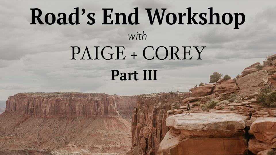
Have questions? We have answers!
We’ll be taking questions over the next couple of months and addressing them in a special blog post! Send us your question and check back to see if your inquiry is picked for our blog post! And be sure to check back every month for a new episode of the Road’s End Workshop, with Paige and Corey!
