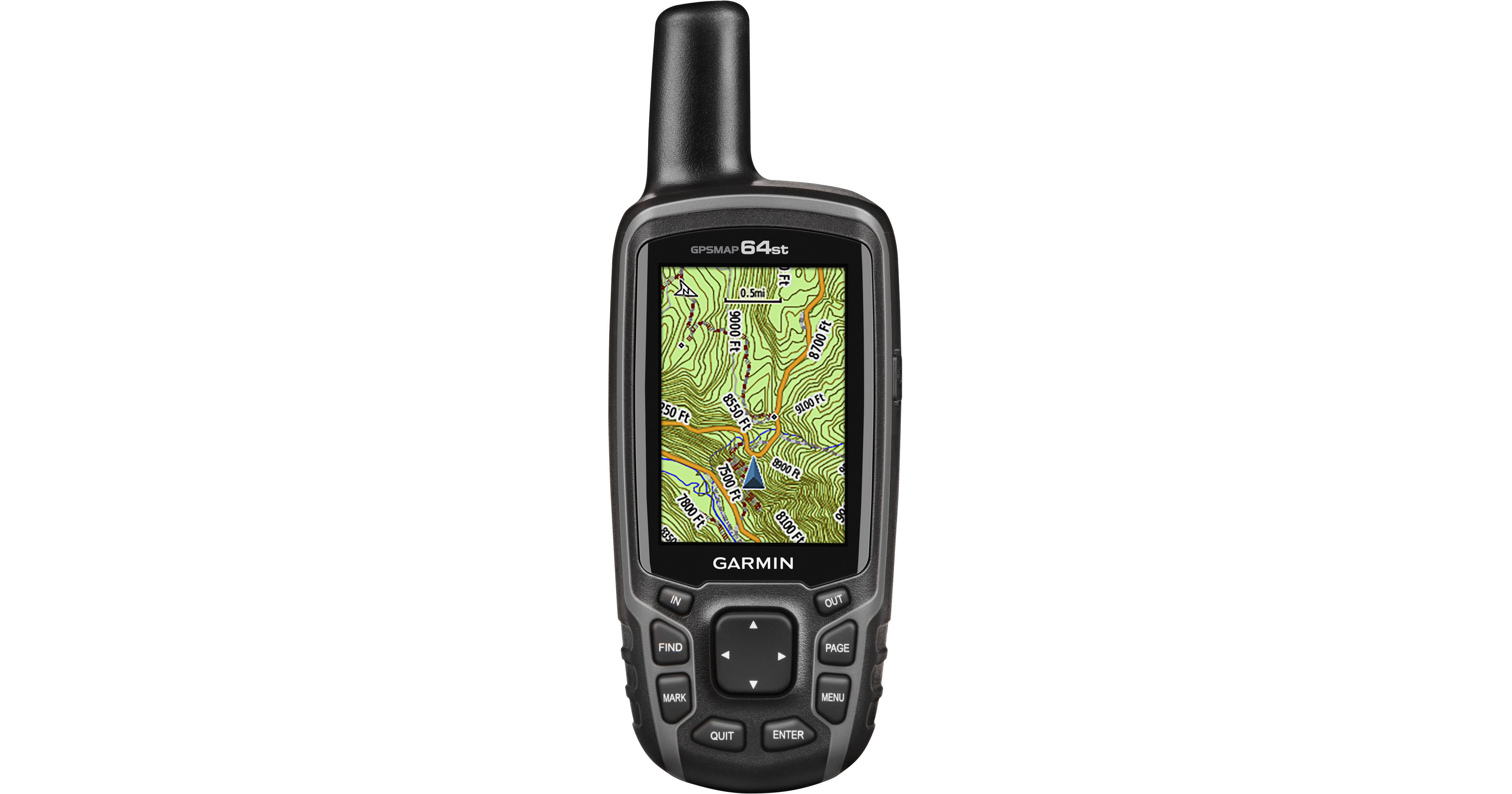
Garmin GPSMAP 64st Handheld GPS

BH #GAGPSMAP64G • MFR #010-01199-20
Print
Garmin GPSMAP 64st Handheld GPS
Key Features
  • BirdsEye Satellite Imagery Subscription
  • Preloaded TOPO US 100k Maps
  • Utilizes GPS and GLONASS Satellites
  • 3-Axis Compass
Whether you are about to embark on an expedition to the ends of the Earth or a more subdued day hike, the Garmin GPSMAP 64st has features you will appreciate. This GPS unit's 2.6" screen lets you easily navigate through its many features as well as its pre-loaded topographic maps and satellite photos. A 3-axis compass is built-in so you will always know your heading. An altimeter lets you know how far you are above sea level, and can help predict weather trends. The unit runs off two AA batteries or the optional rechargeable NiMH pack.
More Details
No Longer Available
No Store Display
Ask an Expert
800-606-6969

Garmin 64st Overview

Whether you are about to embark on an expedition to the ends of the Earth or a more subdued day hike, the Garmin GPSMAP 64st has features you will appreciate. This GPS unit's 2.6" screen lets you easily navigate through its many features as well as its pre-loaded topographic maps and satellite photos. A 3-axis compass is built-in so you will always know your heading. An altimeter lets you know how far you are above sea level, and can help predict weather trends. The unit runs off two AA batteries or the optional rechargeable NiMH pack.

Purchase of this unit also includes a 1-year subscription to BirdsEye Satellite Imagery. This service provides you with up-to-date aerial images of the terrain you are navigating so you can plan the best route. This also allows you to find parking areas, trailheads, and possible places to camp. These views are also useful for geocaching activities.

This unit utilizes both GPS and GLONASS satellites for quicker signal acquisition so you get a fix on your position approximately 20 times faster than GPS alone. A worldwide basemap is stored on the unit's internal memory so you will always have an idea of where you are. The unit's built-in 3-axis tilt-compensated electronic compass shows your heading even while standing still, no matter how it is positioned. It also houses a barometric altimeter which tracks changes in pressure to pinpoint your precise altitude so you will know your distance from sea level. The altimeter also lets you plot barometric pressure over time which can help you keep an eye on changing weather conditions.

The 64st also features built-in paperless geocaching software, so you can transfer your data to your computer with the supplied USB cord or upload it onto the Web. The unit's screen displays key information, including location, terrain, cache difficulty rating, and hints and descriptions of hiding spots. All of this means no more manually entering coordinates and paper printouts for your geocaching hobby.

You can wirelessly share your data and images using the built-in Bluetooth connectivity with other Garmin devices. This unit also features ANT+ technology so your GPS can communicate with other devices so equipped such as heart rate, cadence, chirp and tempe sensors. Smart notifications let you receive emails, texts and more, right on the screen from your iPhone 4s or later wirelessly.

Store up to 5000 waypoints on the receiver's built-in memory as well as 10,000 points and 200 saved tracks. A micro SD card slot lets you load TOPO 24K maps for hiking, Trailhead Series TOPO maps for famous trails, BlueChart g2 charts for boating, or City Navigator NT maps data for turn-by-turn routing on roads.

GPS
  • Utilizes GPS and GLONASS satellites
  • WAAS-Enabled receiver
  • HotFix satellite prediction
  • 3-Axis Compass
  • Barometric altimeter
  • Cartography
  • 1-Year subscription to BirdsEye Satellite Imagery for a photo-realistic view
  • Preloaded TOPO U.S. 100K maps
  • Worldwide basemap with shaded relief
  • Compatible with custom maps
  • Paperless Geocaching Software
  • 5000 waypoint memory
  • Add your own custom points of interest
  • Micro SD card slot lets you add maps
  • Outdoor Features
  • Hunt/fish calendar
  • Sun and moon information
  • Area calculation
  • Compatible with Garmin Basecamp software
  • Tide tables with optional Bluechart
  • Picture viewer
  • Smart Notification lets you wirelessly receive email, texts, and alerts from your compatible iPhone 4s or later
  • Bluetooth to wirelessly transfer data between units
  • ANT+ wireless compatible for use with heart rate, cadence, chirp, and tempe sensors
  • LiveTrack allows you to share your fitness and training progress with friends and family (requires Garmin Connect Mobile)
  • Display
  • 2.6" sunlight-readable display
  • Garmin 64st Specs

    Display Size
    1.43 x 2.15" / 3.6 x 5.5 cm
    Display Size (Diagonal)
    2.6" / 6.6 cm
    Display Resolution
    160 x 240 pixels
    Display Type
    Transflective 65-K color TFT
    Runtime
    16 h
    Stored Waypoints
    5000
    Track Log
    10000 points, 200 saved tracks
    Altimeter
    Yes, barometric
    Compass
    Yes, tilt-compensated 3-axis
    Memory
    8 GB
    Memory Card Slot
    1 x micro SD
    Waterproofing
    IPX7, temporary immersion
    Cable Port
    USB
    Battery
    2 x AA batteries or optional rechargeable NiMH pack
    Dimensions
    2.4 x 6.3 x 1.4" / 6.1 x 16.0 x 3.6 cm
    Weight
    8.1 oz (230 g) with batteries
    Packaging Info
    Package Weight
    0.9 lb
    Box Dimensions (LxWxH)
    7 x 5.5 x 2.2"

    Garmin 64st Reviews

    See any errors on this page?
    Whatever You Need, We've Got It