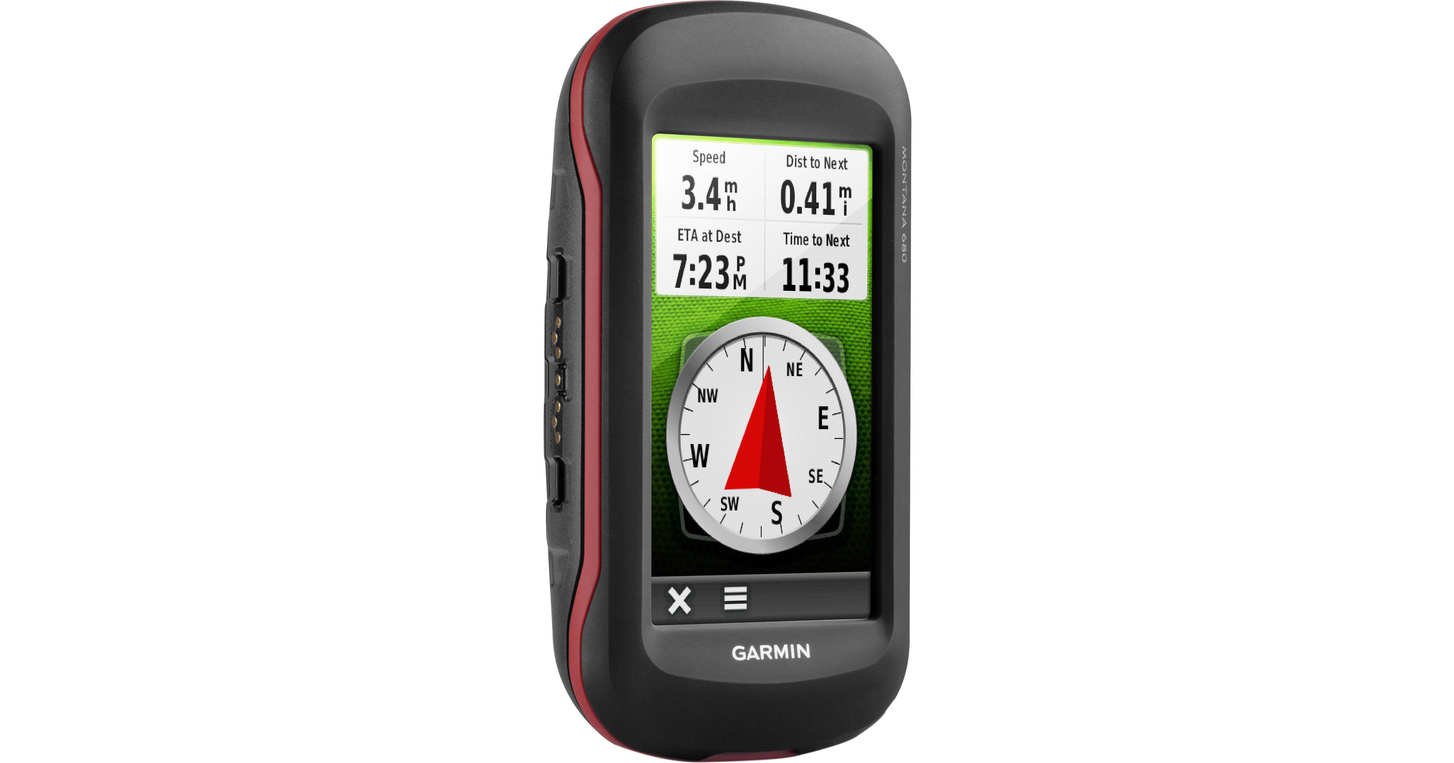
Garmin Montana 680t Handheld GPS

BH #GAM680T • MFR #010-01534-11
Print
Garmin Montana 680t Handheld GPS
Key Features
  • 4" Dual-Orientation Touchscreen Display
  • 8MP Camera
  • BirdsEye Satellite Imagery
  • Worldwide Basemap
Use the 4" sunlight-readable dual-orientation touchscreen of the Garmin Montana 680t Handheld GPS guide you on your next excursion. You can choose between landscape and portrait modes for the best possible view of the map or data you are trying to interpret. Whether you are traveling by foot, boat, or car the free one-year subscription of BirdsEye satellite imagery helps you reach your destination. TOPO U.S. 100K topographic maps illustrate the terrain using relief lines, and the included camera lets you take your own images. All of these 8 megapixel images are geo-tagged automatically so you will know where they were taken.
More Details
No Longer Available
No Store Display
Ask an Expert
800-606-6969

Garmin Montana 680T Overview

Use the 4" sunlight-readable dual-orientation touchscreen of the Garmin Montana 680t Handheld GPS guide you on your next excursion. You can choose between landscape and portrait modes for the best possible view of the map or data you are trying to interpret. Whether you are traveling by foot, boat, or car the free one-year subscription of BirdsEye satellite imagery helps you reach your destination. TOPO U.S. 100K topographic maps illustrate the terrain using relief lines, and the included camera lets you take your own images. All of these 8 megapixel images are geo-tagged automatically so you will know where they were taken.

This unit utilizes both GPS and GLONASS satellites for quicker signal acquisition so you get a fix on your position approximately 20 times faster than GPS alone. The receiver also can interpret Wide Area Augmentation System (WAAS) signals so you can receive information from terrestrial antennas even when your view of the sky is obstructed. The WAAS system also provides greater position accuracy overall. HotFix satellite prediction cuts down on initial signal acquisition by approximating their positions.

The unit's built-in 3-axis tilt-compensated electronic compass shows your heading even while standing still, no matter how it is positioned. It also houses a barometric altimeter which tracks changes in pressure to pinpoint your precise altitude so you will know your distance from sea level. The GPS comes with a rechargeable battery, or you can use AA batteries.

GPS
  • Utilizes GPS and GLONASS satellites
  • WAAS-enabled receiver
  • 3-axis compass
  • Barometric altimeter
  • Connectivity
  • Share data with other Garmin units wirelessly
  • USB
  • NMEA 0183
  • Cartography
  • One-year subscription to BirdsEye satellite imagery
  • Preloaded with TOPO U.S. 100K topograpghic maps
  • Worldwide basemap with shaded relief
  • Paperless Geocaching Software
  • Add your own custom points of interest
  • 4000-waypoint memory
  • microSD card slot lets you add maps
  • Camera
  • 8 megapixel with autofocus
  • Automatic geo-tagging
  • Outdoor Features
  • Paperless geocaching
  • Hunting/fishing calendar
  • Sun and moon information
  • Tide tables with optional Bluechart maps
  • Turn by turn routing on roads with optional mapping
  • Area calculation
  • Compatible with Garmin Basecamp software
  • Picture viewer
  • Garmin Montana 680T Specs

    Key Specs
    Display Size
    4"
    Camera
    Yes
    Application
    Boating/Naval, Forestry, Geocaching, Hiking, Trekking, Hunting, Land Survey, Orienteering, Vehicle
    Waypoints
    4000
    Track Log
    10,000 Points, 200 Saved Tracks
    Battery Type
    Internal (Rechargeable), AA Batteries
    Runtime
    Internal (Rechargeable): 16 h
    Display Size
    4"
    Display Type
    Color LCD
    Internal Memory
    8 GB
    Media/Memory Card Slot
    Single Slot: microSD (Unspecified Type)
    Camera
    Yes
    Dimensions
    5.7 x 2.9 x 1.4" / 14.5 x 7.4 x 3.6 cm
    Packaging Info
    Package Weight
    1.3 lb
    Box Dimensions (LxWxH)
    6.5 x 6.5 x 3.3"

    Garmin Montana 680T Reviews

    See any errors on this page?
    Whatever You Need, We've Got It