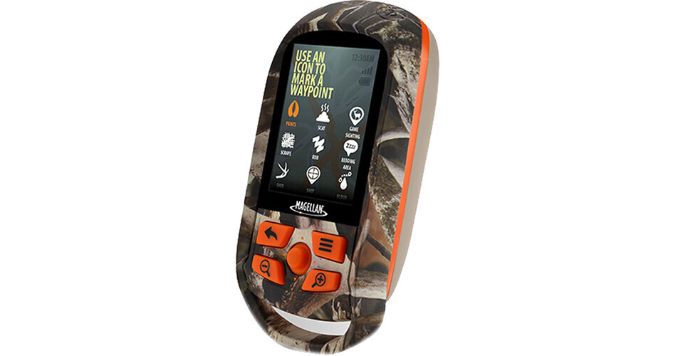
Be more productive on your next hunt with the eXplorist 350H Handheld GPS Navigator from Magellan. This handheld GPS device has many features you will find useful out in the woods, including pre-loaded Hunt and Topo Maps that include contour lines to illustrate elevation. A one year subscription to DigitalGlobe provides aerial views of key terrain features to help predict animal movement. The Wildlife Management Units or Game Management Units for many states are included so you can be sure you are following the correct set of regulations. You can even set up a warning alerting you if you have ventured past the boundary. There are 30 hunting specific waypoint markers for marking trail cameras, terrain features, animal tracks and more. A hunting and fishing calendar highlights peak periods of movement, and sun and moon information help predict sunrise and set times.
The camouflage casing of the Explorist 350H Handheld GPS Navigator is waterproof to IPX7 standards so it is protected against a quick dip. The 2.2" diagonal color screen is transmissive so you can read it, even in harsh sunlight. In addition to the GPS satellites, this GPS also uses the terrestrial WAAS, EGNOS, and MSAS systems for greater accuracy even when your view of the sky is obstructed which ensures 3-5 meters of accuracy. You may store up to 2000 waypoints on the 500 megabytes of user memory available, or upload your own GPX coordinates. This unit will run up to 18 hours continuously on two AA batteries, and you can increase that time by putting the device in suspend mode
Ask Our Experts800-606-6969
Hello, Log InAccount & Orders
Magellan eXplorist 350H Handheld GPS Navigator
Key Features
- WAAS, EGNOS, and MSAS Enabled
- Pre-loaded Hunt and Topo Maps
- 1 Year Subscription to DigitalGlobe
- WMU and GMU Boundaries
Be more productive on your next hunt with the eXplorist 350H Handheld GPS Navigator from Magellan. This handheld GPS device has many features you will find useful out in the woods, including pre-loaded Hunt and Topo Maps that include contour lines to illustrate elevation. A one year subscription to DigitalGlobe provides aerial views of key terrain features to help predict animal movement. The Wildlife Management Units or Game Management Units for many states are included so you can be sure you are following the correct set of regulations. You can even set up a warning alerting you if you have ventured past the boundary. There are 30 hunting specific waypoint markers for marking trail cameras, terrain features, animal tracks and more. A hunting and fishing calendar highlights peak periods of movement, and sun and moon information help predict sunrise and set times.
More DetailsNo Longer Available
Magellan CX0350SGBNA Overview
Hunting Specific Features
GPS
Display
Cartography
Magellan CX0350SGBNA Specs
Key Specs
| Display Size | |
| Camera |
| Application | |
| Waypoints | |
| Track Log | |
| Battery Type | |
| Runtime | |
| Display Size | |
| Display Type | |
| Internal Memory | |
| Media/Memory Card Slot | |
| Backup Camera Compatible | |
| Camera | |
| Dimensions |
Packaging Info
| Package Weight | |
| Box Dimensions (LxWxH) |
Magellan CX0350SGBNA Reviews
See any errors on this page?