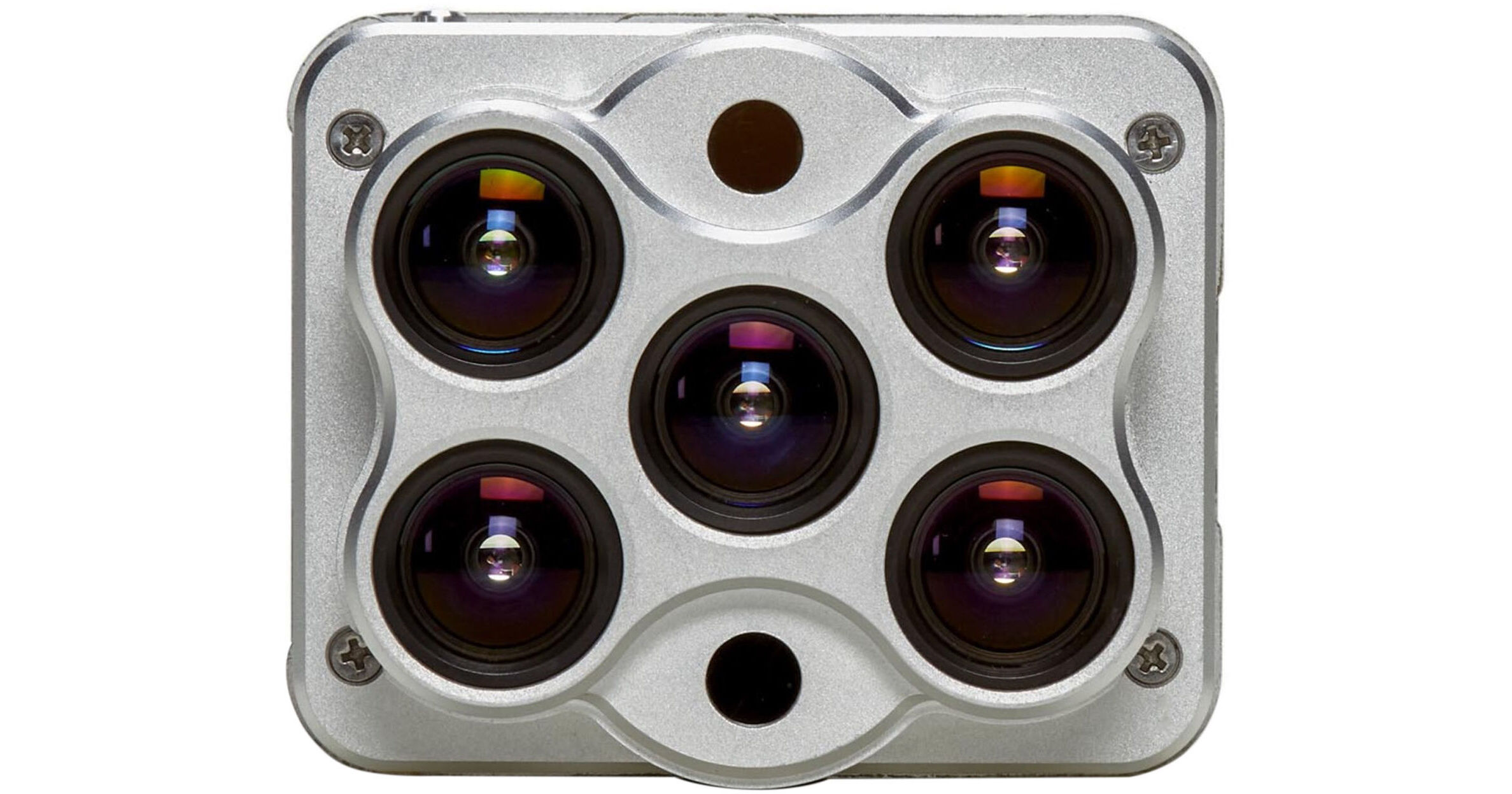
For those in the agricultural industry that utilize drones for crop surveying and maintenance, the Altum Multispectral Drone Sensor from MicaSense delivers five high-resolution lenses and one sensor that does the job of three. This all-in-one solution is synchronized to provide simultaneous thermal, multispectral, and hi-res RGB image capture, allowing you to perfectly overlay images, gaining comprehensive crop information and their real-world location in the field. To help assist with accurate surveying results, the Altum sensor includes a DLS 2 (Downwelling Light Sensor) with embedded GPS and a compact CRP 2 (Calibrated Reflectance Panel) for accurate light calibration.
Synchronized Sensor
The single sensor of the Altum does the job of three, giving you thermal imaging powered by FLIR, hi-res RGB pictures, and hi-res multispectral images in red, green, blue, red edge, and near-infrared spectrums. The multispectral output can deliver a host of crop measurements, including NDVI, while thermal images provide heat maps, and RGB pictures give you real-world visuals and crop location data.
Crop Management
With the Altum on your drone, its imaging capabilities can assist in a wide range of agricultural information gathering, such as:
- Phenotyping: Understand how different breeds react to certain environments and modify desirable traits to improve yield.
- Crop Health Mapping: Capturing visible and invisible bands, including thermal, letting you generate indices to detect early signs of crop stress and compare that data over time. You can also learn your plant's health, using slight temperature changes to isolate sick plants.
- Water Management: Identify overspray or missed areas by the difference in crop and soil temperature.
- Leak Scouting: Identify irrigation leaks by seeing the cooler temperatures of vegetation that has come into contact with water.
- Fertilizer Management: Identify areas low in nutrients and monitor the effects of fertilizer application.
- Disease Identification: Using multispectral and thermal images, you can identify diseases before symptoms are visible.
- Plant Classification: Specialized software and algorithms use hi-res images to classify plants by size, species, and canopy closure.
- Species Differentiation: Multispectral data highlights chlorophyll content, vigor, and leaf size to determine plant species
- Plant Counting: Multispectral data can feeds algorithms in optional software to determine plant count, speeding up more accurate yield predictions.
- Weed Detection: Weeds can be highlighted and differentiated from core crops, isolating them for future removal.
- Advanced Crop Scouting: Collect accurate and geotagged information of crop issues in a single flight.
- Terrain Modeling: The calibrated multispectral imaging can create a DSM (Digital Surface Model) for insights into water management, land use, and terrain elevation.
Compact CRP 2
This compact Calibrated Reflectance Panel (CRP) is easy to take with you to the field before a flight. It contains known reflectance values across the visible and near-infrared light spectrum. Capture an image of the CRP 2 before and after a flight to accurately represent current lighting conditions during the flight for better overall results.
Additional Features
- 128GB USB 3.0 external storage device included
- GSD (Ground Sample Distance) down to 2"
- 2064 x 1544 (3.2MP per EO band) sensor resolution from up to 400'
- Fast capture rate of one capture per second at 12-bit raw across all bands
- Thermal and multispectral sensors are radiometrically calibrated
- 4.9 to 25.2V range to make complex integrations easier
- Weighs only 12.6 oz for maximum drone compatibility