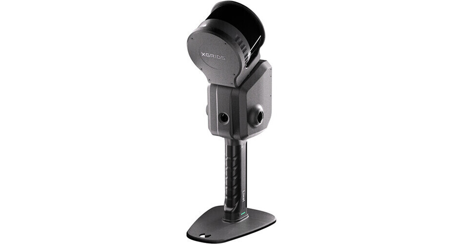
Quickly scan and capture your environment in real-time for 3D modeling with the Lixel L2 Pro Premium Package from XGrids. This scanner provides AI-powered LiDAR, visual camera capture, and a high-precision 6DOF IMU to capture fine, high-quality detail and process in real time without any postprocessing. The integrated rotating LiDAR module provides 16-channel capture in a 394' pickup area.
The Premium Package includes the Lixel L2 Pro scanner, two battery handles, a charger, a smartphone mount, a GCP collection plate, a USB-C Cable, a protective cover, and a case.
Optimized All-in-One Design
The Lixel L2 Pro provides stable multi-SLAM joint optimization algorithms that ensure reliable capture in challenging environments, especially in locations that have satellite signal limitations such as train tunnels. Using dual 48MP 360° panoramic cameras that capture rich color data, the 360° rotating LiDAR provides comprehensive spatial coverage at 1 million points with 1mm spacing and 5mm point cloud thickness for accurate mapping and line drawing.
GCP Collection Plate
The included GCP Collection Plate allows you to utilize ground control point (GCP) scanning using control points. The plate mounts onto the base of the L2 Pro battery handle and features a target with a bullseye to guide you through reference points in a space for hyper-accurate georeferencing, surveying, and mapping. Simply click the control point button in the LixelGO app to add the point to your capture.
Real-Time Output
The L2 Pro provides real-time point cloud data with no wait-time, and its high-quality real-time coloring effect is on par with postprocessed data.
LixelGO Companion App
The LixelGO companion app provides easy control of your L2 Pro scanner using one-click operation. It allows you to control operations such as RTK settings, breakpoint rescanning, and it provides real-time viewing of camera images, elevation information, and true-color point clouds to avoid missing or incorrect data collection. It also displays status data such as battery power, network, memory, and range.
LixelStudio Software
LixelStudio is a professional point cloud processing with measurement, editing, and CAD export tools. Processing features include SLAM mapping, map fusion, PPK support, and quality control. Analysis features include point-cloud slicing, alignment, measurement, overlays, 2D drawing, and more.
Integration workflows provide connection to remote transmission to cloud services, GPS coordinate systems, and export formats such as AutoCAD, BIM and CAD platforms, and mesh generation.
EAN: 4251522827552