
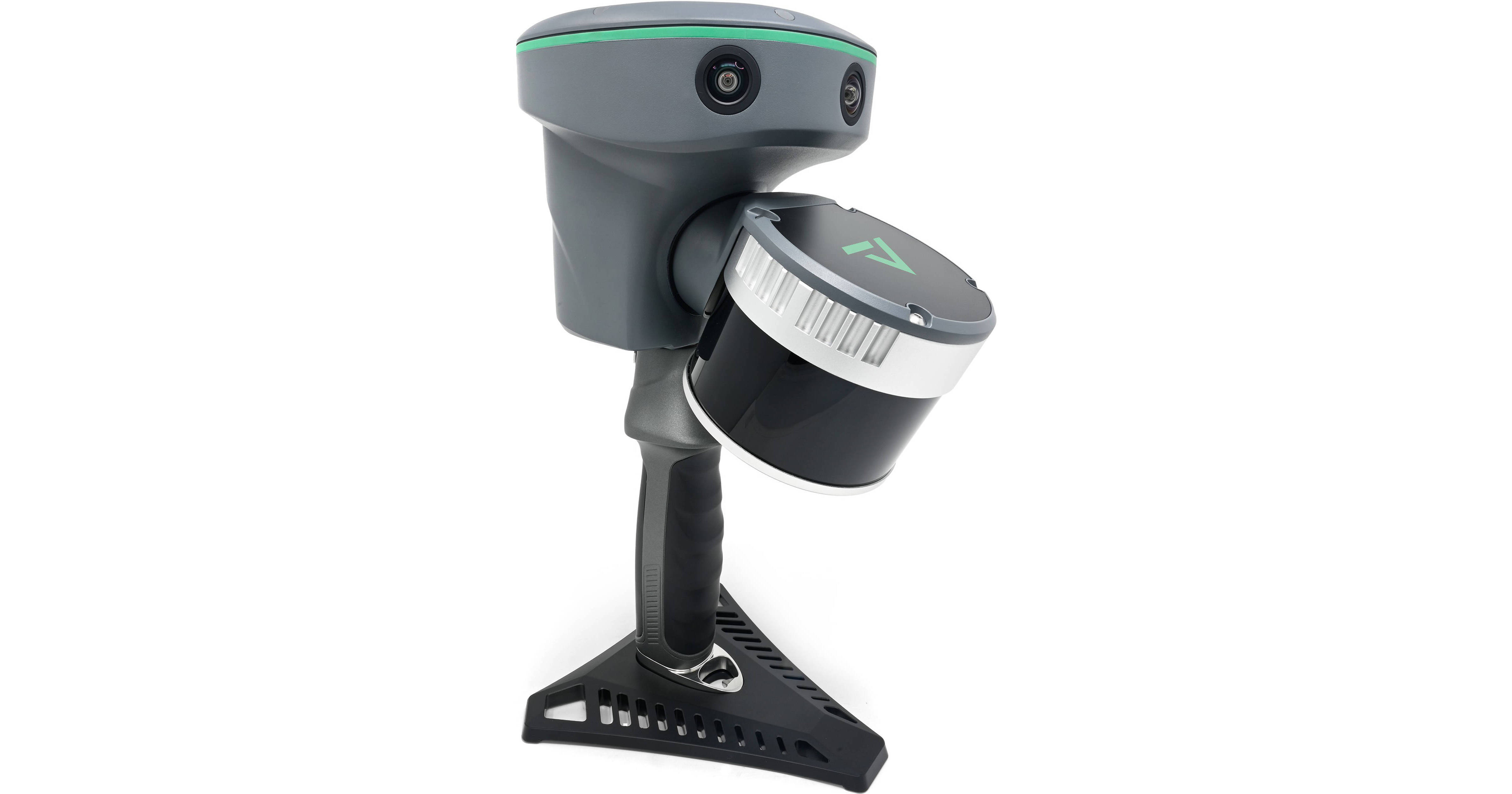
Map interior and exterior spaces in 3D with the TrueView GO 132S Handheld Portable LiDAR Camera from GeoCue and its accurate scanning and processing technology. The TrueView GO 132S features 32 channels, three 5MP RGB cameras, and a sophisticated 3D LiDAR and imagery scanner capable of completing scans from up to 984.3' away. An included tablet with TrueView GO software helps facilitate real-time monitoring and control. 512GB of internal storage keeps your files in a central location for upload to your database later.
Accurate 3D Mapping
The TrueView GO calculates accurate RTK point coordinates using LiDAR and visual SLAM data for accuracy within 1.97" in just one minute. This accuracy extends to areas without satellite signals for use in indoor spaces and populated areas.
Real-Time Scanning and Viewing
The handheld scanner includes a dedicated tablet equipped with TrueView GO software, allowing you to view your collected point cloud in real time to ensure you covered everything. Combine various data sets to create a digital twin of any product, merging data from drone and mobile mapping LiDAR systems. A total field of view of 210 x 170° ensures the camera covers every corner of your space. The tablet software calculates 3D coordinates in real time with an accuracy of 1.97" within a range of up to 49.2'.
Loop-Free Path Planning
SLAM technology eliminates the need for traditional loop closure and overlap, reducing the time and distance required for project completion. Plan out your pathing efficiently using TrueView GO's GNSS coverage.